RoutesNorth America
Three Weeks on a USA Southwest Road Trip
A desert loop through Utah and Arizona's national parks by car.
Save
Dotted path is schematic (great-circle-ish arcs between stops), not a transport route.
Stop by stop
Click a stop (or its pin on the map) for costs, country facts and what to do there.
1Las Vegas USPick up the rental car and stock up before heading into the desert.2 nights
We do not hold a full destination profile for Las Vegas or its country yet, so there are no cost, climate or visa figures for this stop; the route notes describe what it involves.
car to Springdale · about 3.0 hours
2Springdale (Zion) USRide the Zion Canyon shuttle and hike the Narrows or Angels Landing with a permit.3 nights
We do not hold a full destination profile for Springdale (Zion) or its country yet, so there are no cost, climate or visa figures for this stop; the route notes describe what it involves.
car to Bryce Canyon · about 2.0 hours
3Bryce Canyon USWalk the rim at sunrise and hike the Navajo Loop and Queens Garden trails.2 nights
We do not hold a full destination profile for Bryce Canyon or its country yet, so there are no cost, climate or visa figures for this stop; the route notes describe what it involves.
car via Scenic Byway 12 and Capitol Reef to Moab · about 5.0 hours
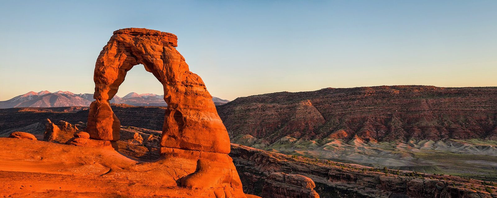
4Moab USHike to Delicate Arch and drive the Island in the Sky district of Canyonlands.3 nights
We do not hold a full destination profile for Moab or its country yet, so there are no cost, climate or visa figures for this stop; the route notes describe what it involves.
car to Monument Valley · about 2.5 hours
5Monument Valley USDrive the valley loop or join a Navajo-guided tour at sunset.1 night
We do not hold a full destination profile for Monument Valley or its country yet, so there are no cost, climate or visa figures for this stop; the route notes describe what it involves.
car to Page · about 2.0 hours
6Page USTake a guided Antelope Canyon tour and walk to Horseshoe Bend.2 nights
We do not hold a full destination profile for Page or its country yet, so there are no cost, climate or visa figures for this stop; the route notes describe what it involves.
car via Desert View to the Grand Canyon South Rim · about 3.0 hours
7Grand Canyon Village USWalk the Rim Trail and watch sunrise from Mather or Yavapai Point.2 nights
We do not hold a full destination profile for Grand Canyon Village or its country yet, so there are no cost, climate or visa figures for this stop; the route notes describe what it involves.
car to Sedona · about 2.5 hours
8Sedona USHike the red rock trails around Cathedral Rock and Devil's Bridge.3 nights
We do not hold a full destination profile for Sedona or its country yet, so there are no cost, climate or visa figures for this stop; the route notes describe what it involves.
Utah's canyons
Leaving Las Vegas, the road reaches Zion National Park in under three hours. A park shuttle runs along the main canyon for much of the year, giving access to the Riverside Walk, the Narrows (wading upriver) and the exposed Angels Landing trail, which now requires a permit through a lottery. Bryce Canyon, a short drive north-east, is a high plateau rim above a natural amphitheatre of orange hoodoos; the Navajo Loop and Queens Garden trails drop among them.
Scenic Byway 12 to Moab
The drive from Bryce to Moab follows Scenic Byway 12 and passes through Capitol Reef National Park, one of the most varied drives in the region. Moab is the base for Arches National Park, where the hike to Delicate Arch is the best known walk, and for Canyonlands' Island in the Sky district with its overlooks above the Green and Colorado rivers. Arches has used a timed-entry reservation system in peak season in recent years.
Navajo Nation and the Grand Canyon
Heading south into the Navajo Nation, Monument Valley's sandstone buttes can be seen from a dirt loop road or on a guided tour with a Navajo operator. Page, on Lake Powell, is the base for Horseshoe Bend and for Antelope Canyon, which is visited only on guided tours run by Navajo-authorised companies. The road then follows the Desert View drive into Grand Canyon National Park's South Rim, where rim trail walks and sunrise viewpoints fill two days. The route ends among the red rocks of Sedona, with hiking trails right out of town, two hours from Phoenix airport.
Practical notes
Visas: Visa Waiver Program travellers need an approved ESTA before travel; others need a US visa, so check the official source. Transport: A rental car is essential; one-way drop-off from Las Vegas to Phoenix usually costs extra, and distances between fuel stops can be long. Weather: Spring and autumn are the most comfortable; summer brings extreme heat at lower elevations and flash flood risk in slot canyons, while winter can close high roads at Bryce and the Grand Canyon North Rim. Budget: The mid figure assumes two people sharing a car and motel or hotel rooms, park entry fees, a guided Antelope Canyon tour and Monument Valley entry; non-US residents now pay higher national park fees, so check the NPS site. Safety: Heat, dehydration and flash floods are the main risks; carrying ample water and checking ranger forecasts before canyon hikes is standard practice.