RoutenSouth America
Three Weeks in Ecuador and the Galapagos
Andean markets and crater lakes, then a land-based week in the Galapagos.
Speichern
Der gepunktete Pfad ist schematisch (ungefähre Großkreisbögen zwischen den Stopps) und keine Transportroute.
Station für Station
Klicke auf einen Stopp (oder seine Markierung auf der Karte) für Kosten, Länderinformationen und Aktivitäten vor Ort.
1Quito ECWalk the colonial centre and ride the TeleferiQo up Pichincha.3 Nächte
Wir haben kein vollständiges Reiseziel-Profil für Quito oder das zugehörige Land noch nicht erfasst, daher gibt es für diesen Stopp keine Kosten-, Klima- oder Visumsdaten; die Routenhinweise beschreiben, was dieser Abschnitt beinhaltet.
bus to Otavalo · über 2.5 Stunden
2Otavalo ECBrowse the Saturday market and walk around the Cuicocha crater lake.2 Nächte
Wir haben kein vollständiges Reiseziel-Profil für Otavalo oder das zugehörige Land noch nicht erfasst, daher gibt es für diesen Stopp keine Kosten-, Klima- oder Visumsdaten; die Routenhinweise beschreiben, was dieser Abschnitt beinhaltet.
bus via Quito to Latacunga, then bus to Quilotoa · über 6.0 Stunden
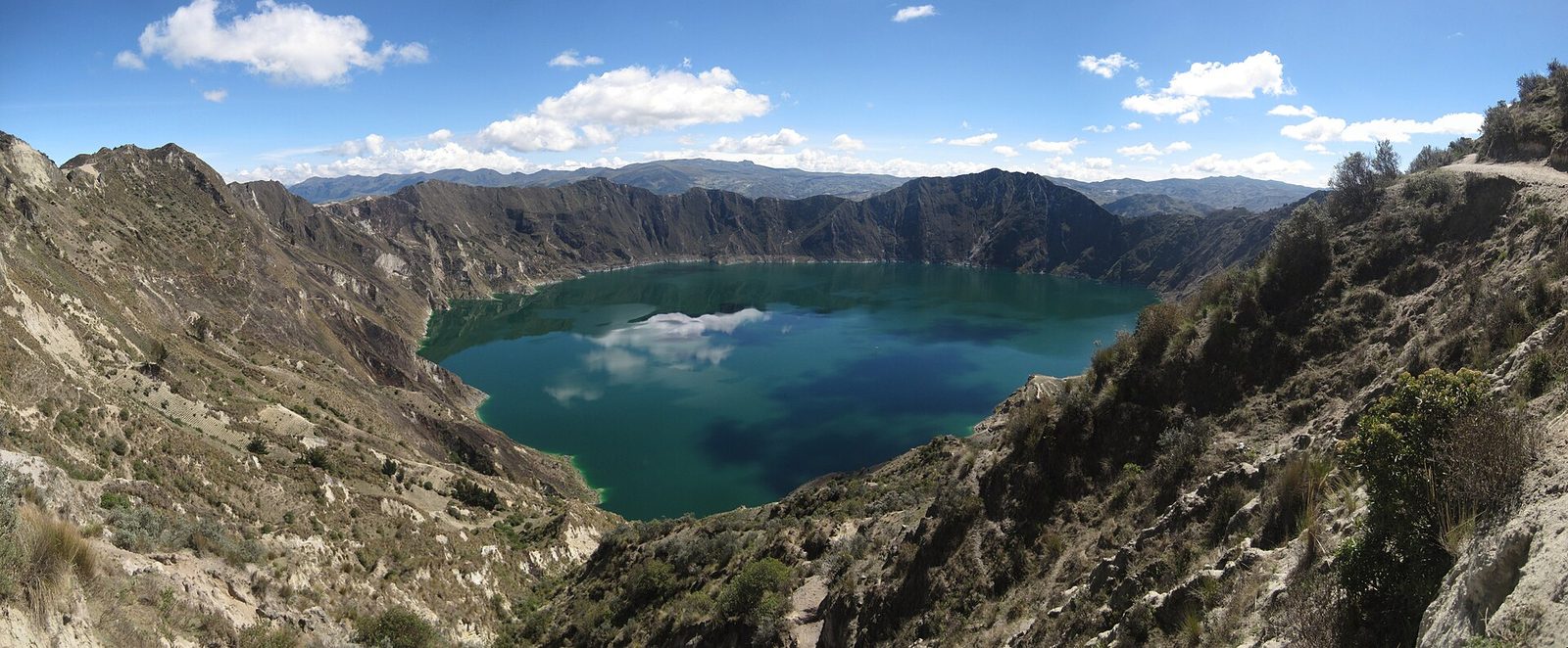
3Quilotoa ECWalk the crater rim and hike between villages on the Quilotoa loop.2 Nächte
Wir haben kein vollständiges Reiseziel-Profil für Quilotoa oder das zugehörige Land noch nicht erfasst, daher gibt es für diesen Stopp keine Kosten-, Klima- oder Visumsdaten; die Routenhinweise beschreiben, was dieser Abschnitt beinhaltet.
bus to Latacunga, then bus to Banos · über 4.5 Stunden
4Banos ECSoak in the thermal baths, cycle the waterfall route and visit the Casa del Arbol swing.3 Nächte
Wir haben kein vollständiges Reiseziel-Profil für Banos oder das zugehörige Land noch nicht erfasst, daher gibt es für diesen Stopp keine Kosten-, Klima- oder Visumsdaten; die Routenhinweise beschreiben, was dieser Abschnitt beinhaltet.
bus via Riobamba to Cuenca · über 8.0 Stunden
5Cuenca ECExplore the colonial centre and day-trip to Cajas National Park.3 Nächte
Wir haben kein vollständiges Reiseziel-Profil für Cuenca oder das zugehörige Land noch nicht erfasst, daher gibt es für diesen Stopp keine Kosten-, Klima- oder Visumsdaten; die Routenhinweise beschreiben, was dieser Abschnitt beinhaltet.
bus to Guayaquil, then flight to Baltra and transfer to Puerto Ayora · über 9.0 Stunden
6Puerto Ayora, Santa Cruz ECSee the Darwin Station, highland tortoises and Tortuga Bay, with a day boat tour.3 Nächte
Wir haben kein vollständiges Reiseziel-Profil für Puerto Ayora, Santa Cruz oder das zugehörige Land noch nicht erfasst, daher gibt es für diesen Stopp keine Kosten-, Klima- oder Visumsdaten; die Routenhinweise beschreiben, was dieser Abschnitt beinhaltet.
public speedboat to Isabela · über 2.5 Stunden
7Puerto Villamil, Isabela ECHike to the Sierra Negra caldera and snorkel the lava tunnels.3 Nächte
Wir haben kein vollständiges Reiseziel-Profil für Puerto Villamil, Isabela oder das zugehörige Land noch nicht erfasst, daher gibt es für diesen Stopp keine Kosten-, Klima- oder Visumsdaten; die Routenhinweise beschreiben, was dieser Abschnitt beinhaltet.
Quito and the northern highlands
Quito's colonial centre is one of the best preserved in Latin America, and the TeleferiQo cable car climbs the slopes of Pichincha for views over the city. At around 2,850 m, the capital is also where the body begins adjusting to altitude. A bus north reaches Otavalo, whose market is largest on Saturdays, with textiles, produce and crafts from the surrounding Kichwa communities, and nearby walks circle the Cuicocha crater lake.
Quilotoa, Banos and Cuenca
Heading south, the Quilotoa loop links small Andean villages around a turquoise crater lake, and many walkers spend a day or two hiking between village hostels along the canyon. Banos sits in a green valley beneath Tungurahua volcano and is known for thermal baths, the cliff-edge swing at the Casa del Arbol and the cycle route down past waterfalls toward the Amazon basin. A long bus ride ends in Cuenca, a calm colonial city of churches and riverside walks, with Cajas National Park an hour away.
The Galapagos, land based
From Guayaquil, flights reach Baltra for Santa Cruz island, where Puerto Ayora has the Charles Darwin Research Station, giant tortoises in the highlands and the beach at Tortuga Bay. Speedboats run on to Isabela, the largest island, where Puerto Villamil offers lava tunnels, flamingo lagoons and the hike to the Sierra Negra caldera. Island-hopping by public boat and day tour gives a lower-cost alternative to a liveaboard cruise, though it reaches fewer of the outer islands. Strict park rules govern where visitors may walk and how close they may approach wildlife.
Praktische Hinweise
Visas: Most Western passports enter Ecuador visa-free for tourism; the Galapagos also requires a transit control card and a national park entrance fee paid on arrival, which rose sharply in 2024, so check the official park site for the current amount. Transport: Buses throughout the Andes, a flight from Guayaquil to Baltra, and public speedboats between Santa Cruz and Isabela that can be rough. Weather: June to September is the drier season in the highlands; in the Galapagos, December to May brings warmer water and calmer seas, while June to November is cooler with richer marine life. Budget: Ecuador uses the US dollar; the mid figure assumes private rooms on the mainland, mid-range hotels in the islands, the Galapagos flight and fees, and several day tours. Safety: Crime has risen in parts of Ecuador, especially Guayaquil and some coastal provinces, so current official advisories are essential reading; the highland towns and the Galapagos are generally calmer.