المساراتAfrica
Five Weeks Overland in Southern Africa
Cape Town to Victoria Falls through Namibia's dunes and Botswana's delta.
حفظ
المسار المنقّط تخطيطي تقريباً يمثّل أقواساً بين المحطات على طول الدائرة العظمى، وليس طريق مواصلات فعلياً.
توقف بعد توقف
انقر على أي محطة، أو على الدبوس المقابل لها على الخريطة، للاطلاع على التكاليف ومعلومات البلد وما يمكن فعله هناك.
1Cape Town South AfricaTable Mountain, Cape Point, Boulders Beach and a Winelands day.5 ليالٍ
$605 متوسط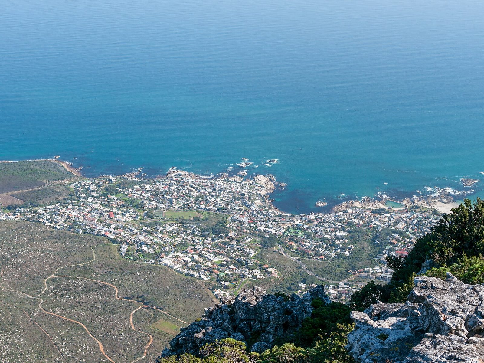 Photo: Matti Blume · CC BY-SA 4.0
Mountain, two oceans, vineyards and a nomad season that follows the northern winter.
Few cities have Cape Town's geography: Table Mountain in the middle, the Atlantic on one side, False Bay on the other, penguins at Boulders, the Winelands forty minutes away and the Garden Route beyond. For travellers earning dollars, euros or pounds it is one of the best-value great cities in the world, with a…
- الميزانية اليومية
- $47–$265 للشخص الواحد، من مستوى حقيبة الظهر إلى المستوى المريح، تقدير تحريري, Oct 2026
- هذه المحطة
- $605 5 ليالٍ بحسب التقدير اليومي للفئة المتوسطة
- أفضل الأشهر
- Nov, Dec, Jan, Feb, Mar, Apr
- الإنترنت
- 100 Mbps سطر ثابت نموذجي، تحريري
أشياء للقيام بها
- Table Mountain Hike Platteklip Gorge or Skeleton Gorge up, cableway down; never alone, never late.
- Cape Point and Chapman's Peak drive The peninsula loop with Boulders' penguins.
- Kirstenbosch gardens Summer sunset concerts under the mountain.
- Bo-Kaap and the city centre Painted houses, Cape Malay cooking classes, First Thursdays galleries.
South Africa: معلومات عملية
- العملة
- South African rand (ZAR) · 16.34 ZAR/USD (Financial Modeling Prep (indicative mid), Nov 05, 2026)
- اللغة
- 11 official languages; English universal in cities
- المقابس الكهربائية والجهد الكهربائي
- C, M, N (230 V)
- ماء الصنبور
- Safe in Cape Town and major cities
- طوارئ
- 10111 police, 10177 ambulance, 112 from mobiles
- التحذير الأمريكي
- المستوى 2
دليل الوجهة الشامل →South Africa دليل البلد →قواعد التأشيرة →
road along the N2 · حول 6.5 ساعات
2Knysna (Garden Route) South AfricaLagoon, forest walks and hikes in the Tsitsikamma section of the national park.4 ليالٍ
لا يتوفر لدينا ملف وجهة كامل لـ Knysna (Garden Route) بعد، لذا لا تتوفر هنا أرقام تكاليف أو مناخ على مستوى المحطة، والمعلومات أدناه على مستوى البلد. أقرب وجهة مدرجة في الموقع: Cape Town (حول 430 km).
South Africa: معلومات عملية
- العملة
- South African rand (ZAR) · 16.34 ZAR/USD (Financial Modeling Prep (indicative mid), Nov 05, 2026)
- اللغة
- 11 official languages; English universal in cities
- المقابس الكهربائية والجهد الكهربائي
- C, M, N (230 V)
- ماء الصنبور
- Safe in Cape Town and major cities
- طوارئ
- 10111 police, 10177 ambulance, 112 from mobiles
- التحذير الأمريكي
- المستوى 2
road to George and flight via Cape Town or Johannesburg · حول 8.0 ساعات
3Windhoek NAStock up and collect a vehicle or join the overland truck.1 ليلة
لا يتوفر لدينا ملف وجهة كامل لـ Windhoek أو بلده بعد، لذا لا تتوفر أرقام للتكاليف أو المناخ أو التأشيرة لهذه المحطة؛ ملاحظات المسار تصف ما تتضمنه.
gravel road drive · حول 5.0 ساعات
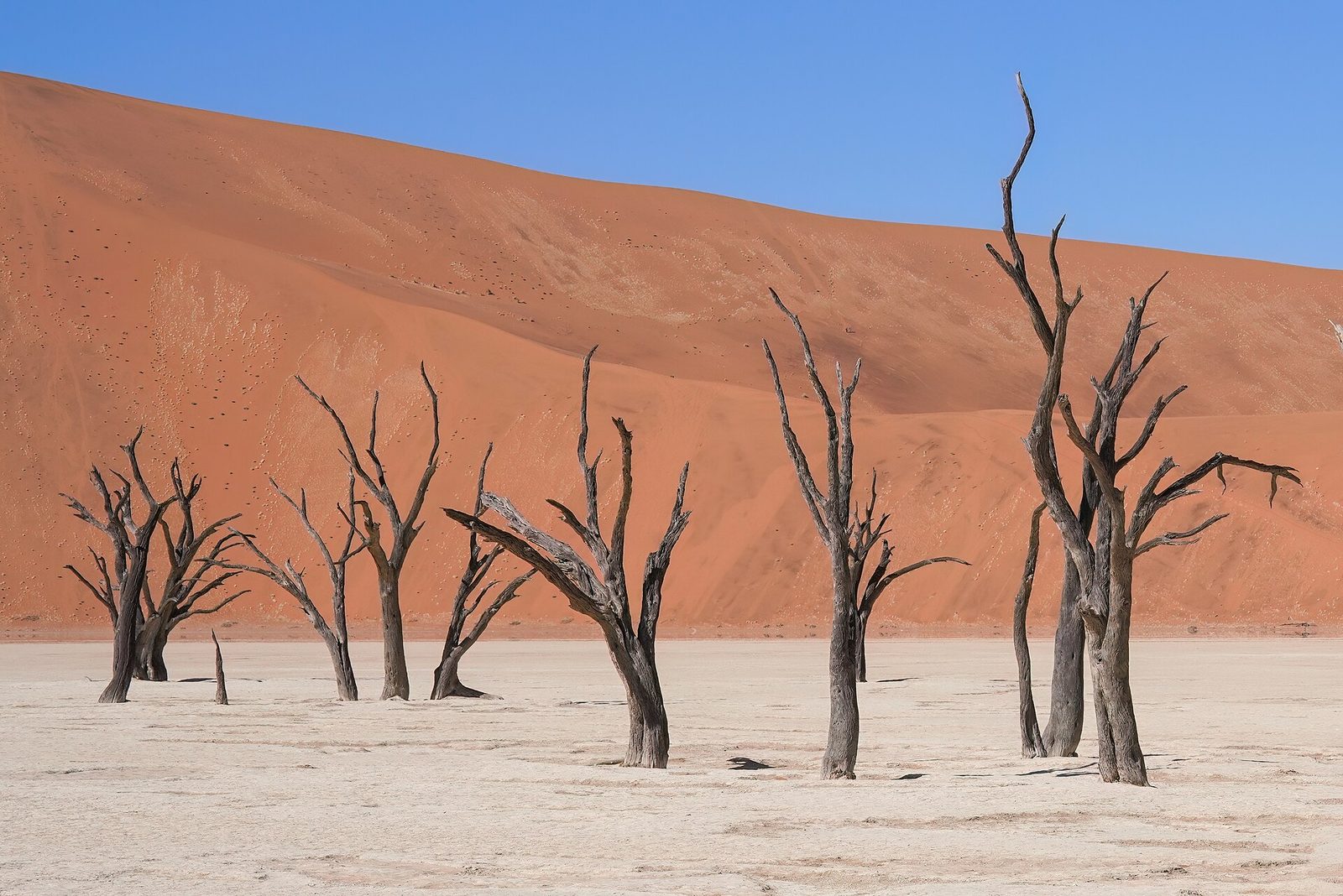
4Sesriem (Sossusvlei) NASunrise dune climbs, Deadvlei and Sesriem Canyon.2 ليالٍ
لا يتوفر لدينا ملف وجهة كامل لـ Sesriem (Sossusvlei) أو بلده بعد، لذا لا تتوفر أرقام للتكاليف أو المناخ أو التأشيرة لهذه المحطة؛ ملاحظات المسار تصف ما تتضمنه.
gravel road drive via Solitaire · حول 5.5 ساعات
5Swakopmund NASandboarding, desert tours and a boat trip from Walvis Bay.3 ليالٍ
لا يتوفر لدينا ملف وجهة كامل لـ Swakopmund أو بلده بعد، لذا لا تتوفر أرقام للتكاليف أو المناخ أو التأشيرة لهذه المحطة؛ ملاحظات المسار تصف ما تتضمنه.
road drive north · حول 5.0 ساعات
6Etosha National Park (Okaukuejo) NAGame drives around the pan and the floodlit Okaukuejo waterhole.3 ليالٍ
لا يتوفر لدينا ملف وجهة كامل لـ Etosha National Park (Okaukuejo) أو بلده بعد، لذا لا تتوفر أرقام للتكاليف أو المناخ أو التأشيرة لهذه المحطة؛ ملاحظات المسار تصف ما تتضمنه.
road via Windhoek and the Trans-Kalahari Highway · حول 11.0 ساعات
7Ghanzi BWKalahari stopover, often with a San-led bush walk.1 ليلة
لا يتوفر لدينا ملف وجهة كامل لـ Ghanzi أو بلده بعد، لذا لا تتوفر أرقام للتكاليف أو المناخ أو التأشيرة لهذه المحطة؛ ملاحظات المسار تصف ما تتضمنه.
road drive · حول 3.5 ساعات
8Maun (Okavango Delta) BWMokoro trip into the delta or a scenic flight over it.3 ليالٍ
لا يتوفر لدينا ملف وجهة كامل لـ Maun (Okavango Delta) أو بلده بعد، لذا لا تتوفر أرقام للتكاليف أو المناخ أو التأشيرة لهذه المحطة؛ ملاحظات المسار تصف ما تتضمنه.
road via Nata · حول 6.5 ساعات
9Kasane (Chobe) BWChobe River boat cruise and a game drive in Chobe National Park.2 ليالٍ
لا يتوفر لدينا ملف وجهة كامل لـ Kasane (Chobe) أو بلده بعد، لذا لا تتوفر أرقام للتكاليف أو المناخ أو التأشيرة لهذه المحطة؛ ملاحظات المسار تصف ما تتضمنه.
road via the Kazungula border · حول 1.5 ساعات
10Victoria Falls ZWThe rainforest path facing the falls and a look from the Zambian side.3 ليالٍ
لا يتوفر لدينا ملف وجهة كامل لـ Victoria Falls أو بلده بعد، لذا لا تتوفر أرقام للتكاليف أو المناخ أو التأشيرة لهذه المحطة؛ ملاحظات المسار تصف ما تتضمنه.
Cape Town and the Garden Route
Cape Town anchors the start: Table Mountain, the Cape Peninsula drive to Cape Point and the penguins at Boulders Beach, Robben Island, and the Winelands an hour inland. The route then heads east along the Garden Route, a stretch of lagoons, forest and coast around Knysna, Wilderness and Plettenberg Bay, with hiking in the Tsitsikamma section of Garden Route National Park. A flight from George connects to Windhoek, usually via Cape Town or Johannesburg.
Namibia: desert, coast and Etosha
Namibia is vast and lightly populated, and most travellers either join an overland truck or hire a 4x4. From Windhoek, gravel roads lead to Sesriem and the red dunes of Sossusvlei, including the dead camel-thorn trees of Deadvlei; a dawn climb of Dune 45 or Big Daddy is the usual routine. The road then crosses to the Atlantic at Swakopmund, a German-colonial seaside town used as a base for sandboarding, desert tours and boat trips from Walvis Bay. Further north, Etosha National Park centres on a huge salt pan, and its floodlit waterholes at camps such as Okaukuejo draw elephant, rhino and lion after dark.
Botswana and Victoria Falls
Back through Windhoek, the Trans-Kalahari Highway crosses into Botswana at Mamuno, with a night in Ghanzi on the edge of the Kalahari. Maun is the gateway to the Okavango Delta, explored by mokoro (dugout canoe) with polers from local communities, or by scenic flight. The road north via Nata reaches Kasane on the Chobe River, where boat cruises pass large herds of elephant. A short crossing at Kazungula leads into Zimbabwe and Victoria Falls, where the rainforest path faces the falls directly and the Zambian side is a short walk across the bridge.
ملاحظات عملية
Visas: South Africa, Namibia and Botswana admit many Western passports visa-free for short stays, while Zimbabwe issues visas on arrival or a KAZA UNIVISA to many nationalities; Namibia has changed its rules for some nationalities recently, so check each country's official immigration source. Transport: overland trucks run this line as scheduled departures with camping or upgraded accommodation; self-drive needs a 4x4 with camping gear and comfort on long gravel roads; George to Windhoek is a connecting flight. Weather: May to October is the dry season inland, with cold desert nights and the best game viewing as animals gather at water; Cape Town is cooler and wetter in those months. Budget: the low figure reflects an overland camping truck; the mid figure assumes a mix of guesthouses and upgraded truck or self-drive accommodation, a mokoro trip and a Chobe cruise; the high figure covers lodges and fly-in delta camps. Safety: Cape Town has well-documented petty and violent crime in some areas, so local guidance matters; on Namibian gravel roads, speed and tyre blowouts are the main risks; check your government's current advice for each country.